
Jenna McBride and Benjamin Bruening live happily at sea-level in the northeastern USA, but are always searching for elevation, whether that be close-to-home in Pennsylvania, New York and New England, or far away in Europe. Once Jenna conquers her fear of bears and other large animals, they hope to explore more of North America, namely the Canadian Rockies.

Jenna and Ben basking in the beauty of Lake Silvaplana
We weren’t planning on returning to Switzerland in 2022. My husband Ben and I had just visited in 2021—a trip where we hiked for eleven perfect days on three sections of the Haute Route and day hikes in Zermatt, Sass Fee, and Lauterbrunnen. We knew we’d return, just not so soon!
Long story short, we originally planned a backpacking trip in Olympic National Park, Washington State in USA for July, but we both came down with bad cases of Covid a few days prior to the trip. We had no choice but to cancel and for various reasons, decided not to rebook. In the weeks that followed, I realized that we wouldn’t be able to do any kind of strenuous backpacking that summer, due to back and knee injuries. We accepted that if we were to have an adventure that year, we would have to change things up.
We decided to tack a shorter Alps trip (September 7-14) onto an annual beach vacation. I looked for direct flights to the Alps and the only one that existed was to Zurich—so back to Switzerland it was! We decided it would be best to stay in one location for the week, ideally somewhere with lifts to assist with descents. On forums, I saw a few people recommend Engadin (Engadine), a valley (and side valleys) in southeastern Switzerland. The region boasts big peaks, glaciers, turquoise lakes, charming villages, tranquil valleys, few(er) tourists, and of course, that impeccable Swiss public transportation.
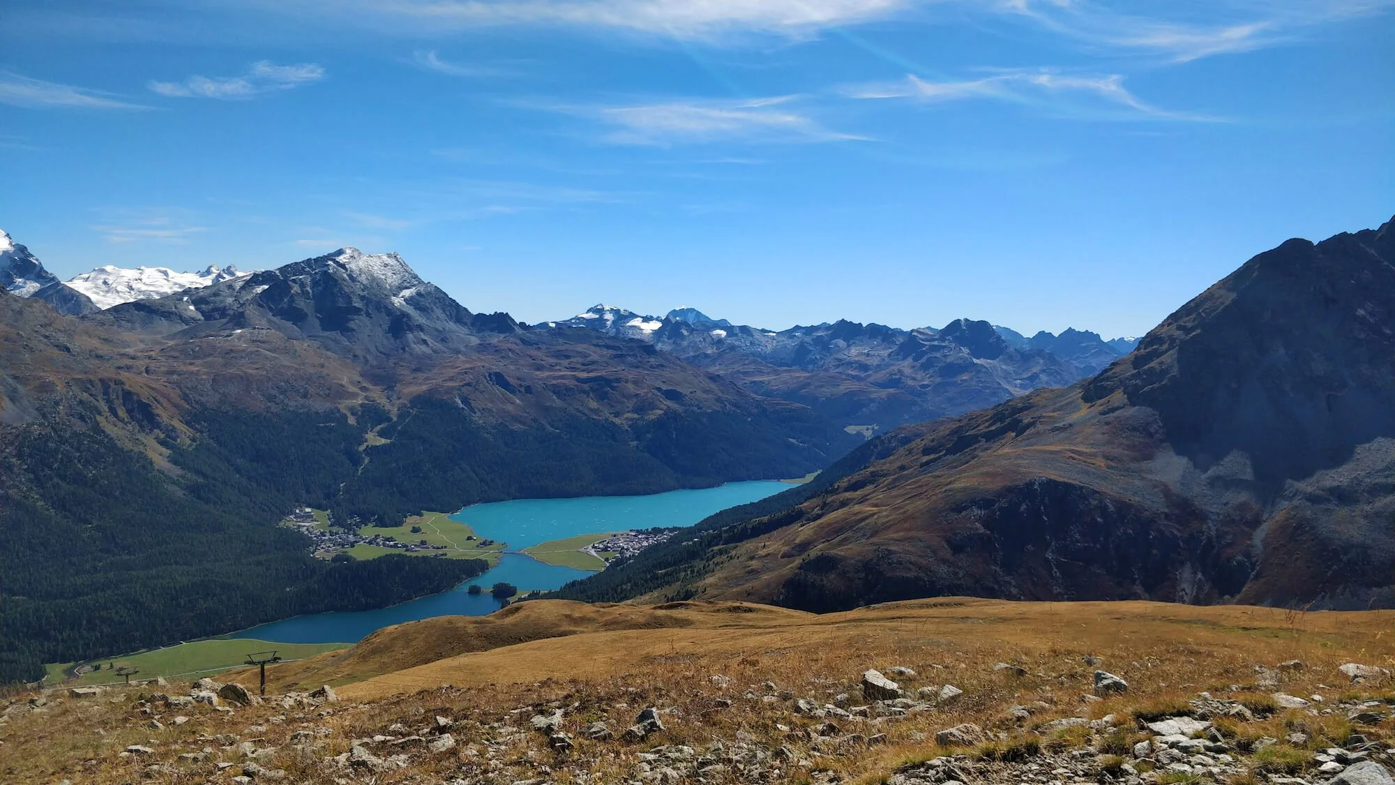
A view of the Engadin Valley, looking south-west
While Ben and I love backpacking, we easily saw the appeal of staying at one hotel the entire week and doing day hikes. We stayed at Hotel Rosatsch in Pontresina, a lovely village in a sunny side valley (Val Bernina). The hotel’s breakfast, hiking poles (to borrow), and Engadin Inclusive Card (free buses, trains, and lifts in the valley) more than sweetened the deal. Each morning we set out on a new adventure and came back to our little home away from home. Here are the hikes we did:
Muottas Muragl to Alp Languard

Route from Muottas Muragl (funicular) to Alp Languard (chairlift)
Distance: 6.6 miles | 10.6 km
Elevation gain/loss: +2,160 ft / -2,510 ft | +658 m / -765 m
Lifts used: Muottas Muragl (funicular) and Alp Languard (chairlift)
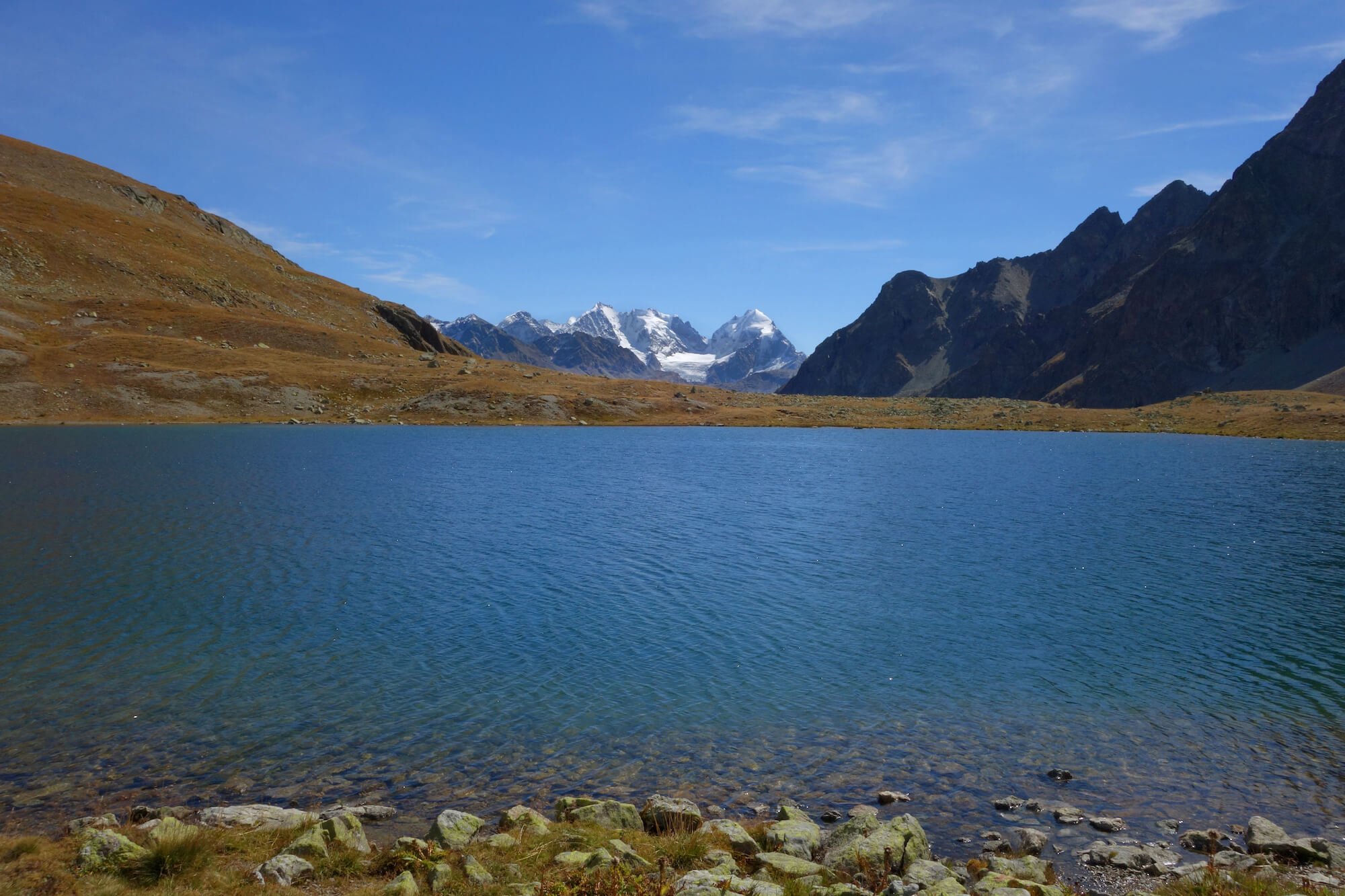
We started the day with an easy walk to the Muottas Muragl funicular (30min), took it to the top, then did a variation on the long route of this hike. The hike was moderate in difficulty but rewarded us with sweeping views, a lunch hut, and a little blue lake (Lej Muragl) nestled against the peaks. We didn’t have cash on us, so unfortunately we weren’t able to delight in a meal at Paradis Hütte. All in all, this was a great first day warm-up hike.
Pontresina to Fuorcla Surlej to Murtèl-Corvatsch
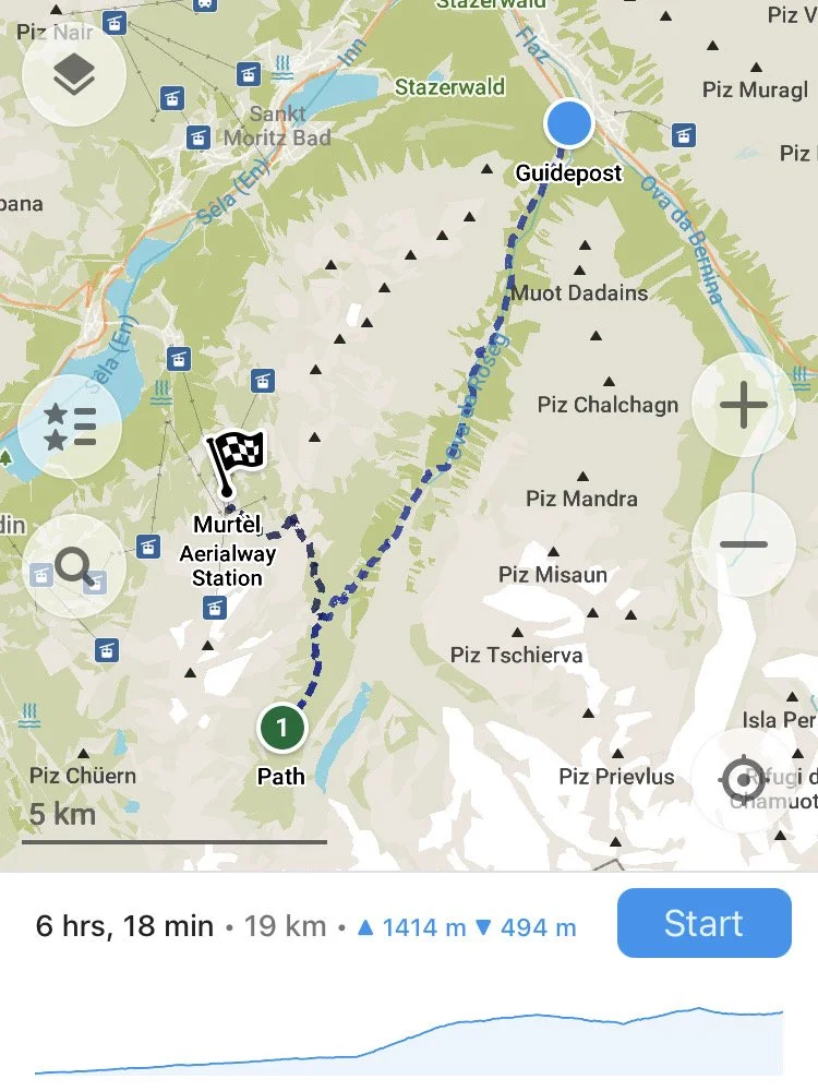
Route from Pontresina to Murtèl-Corvatsch via Fuorcla Surlej
Distance: 13.9 miles | 22 km
Elevation gain/loss: +3,875 ft / -2,360 ft | +1,180 m / -720 m
Lift used: Murtèl-Corvatsch (gondola)
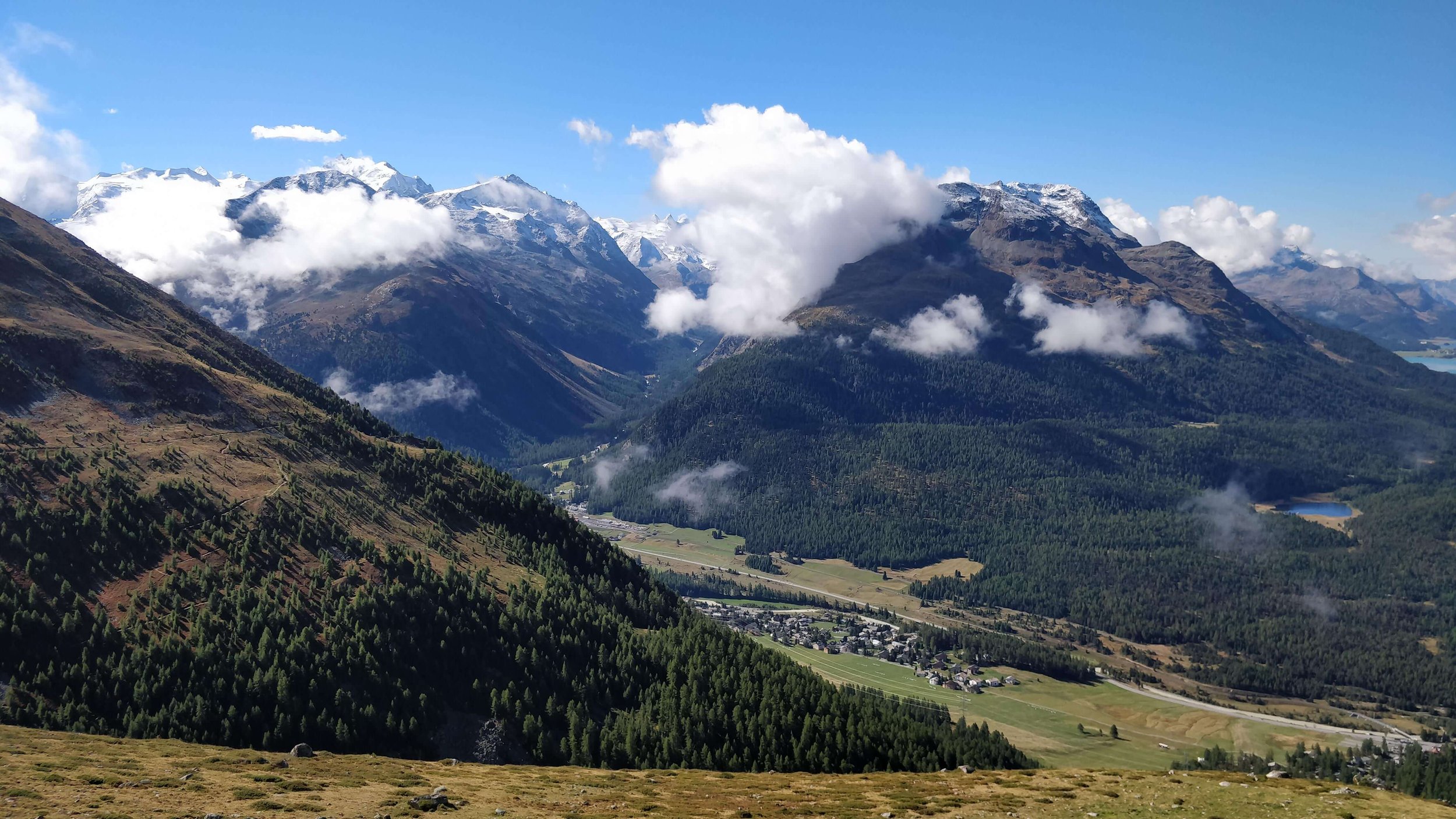
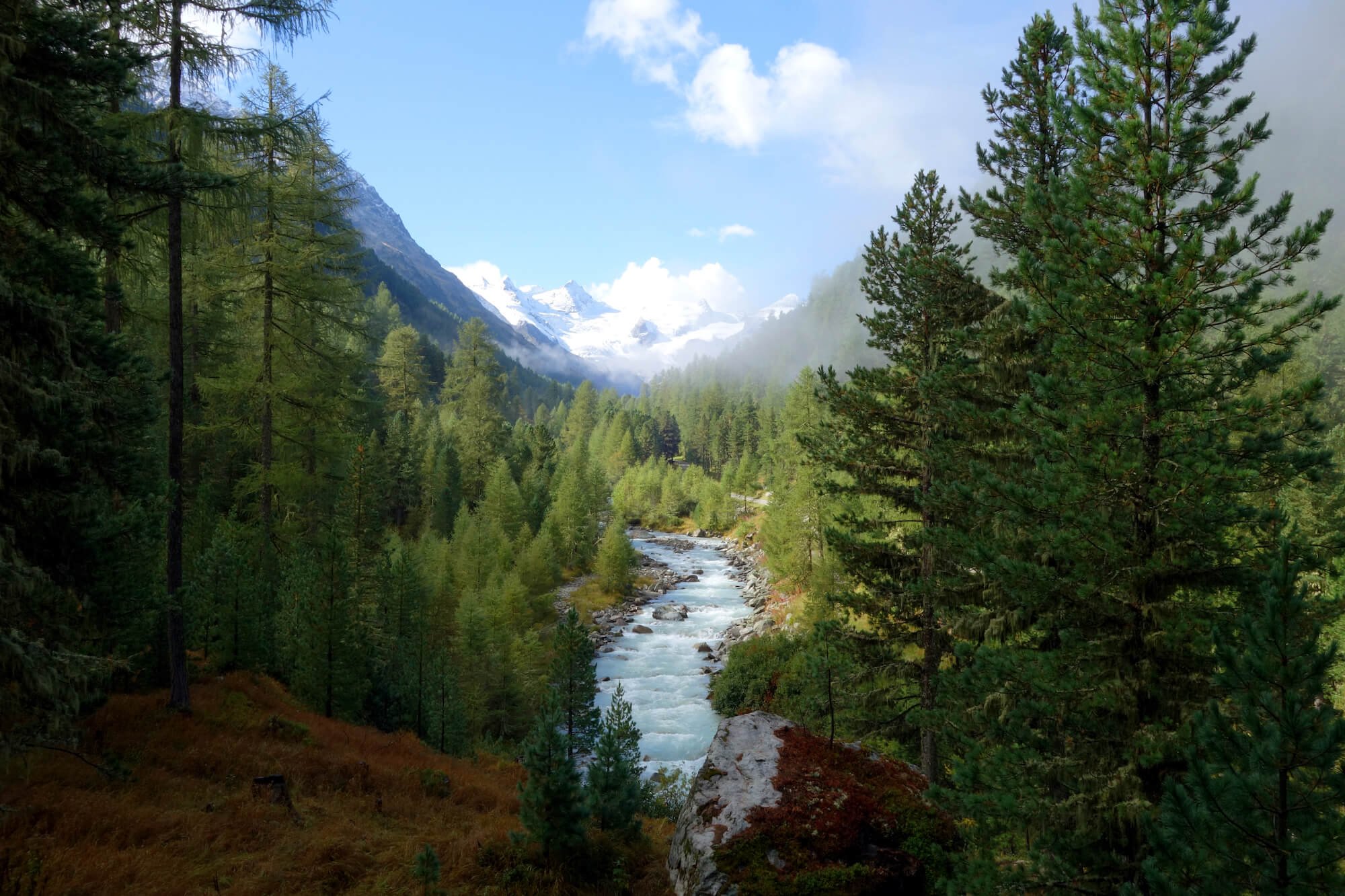
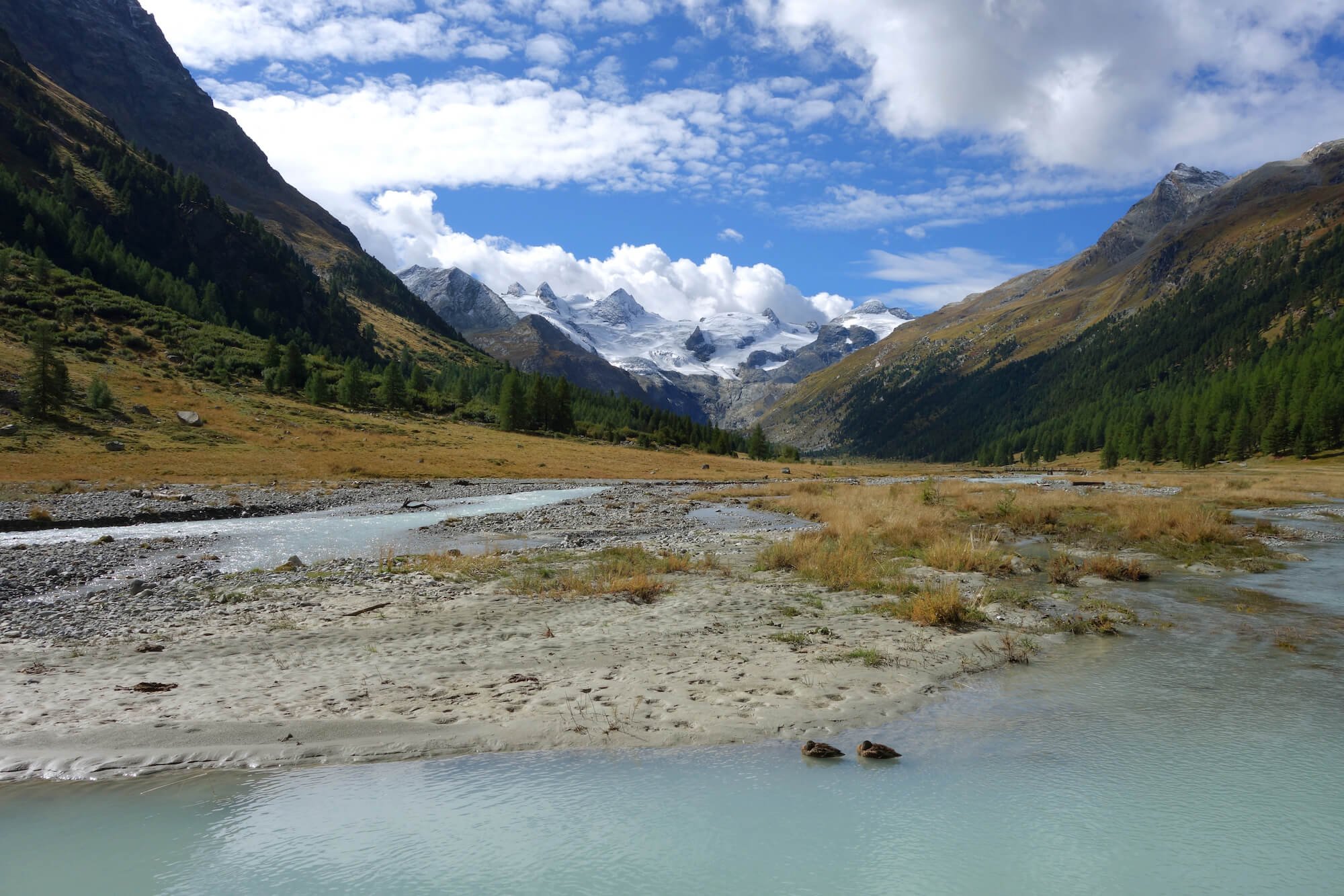
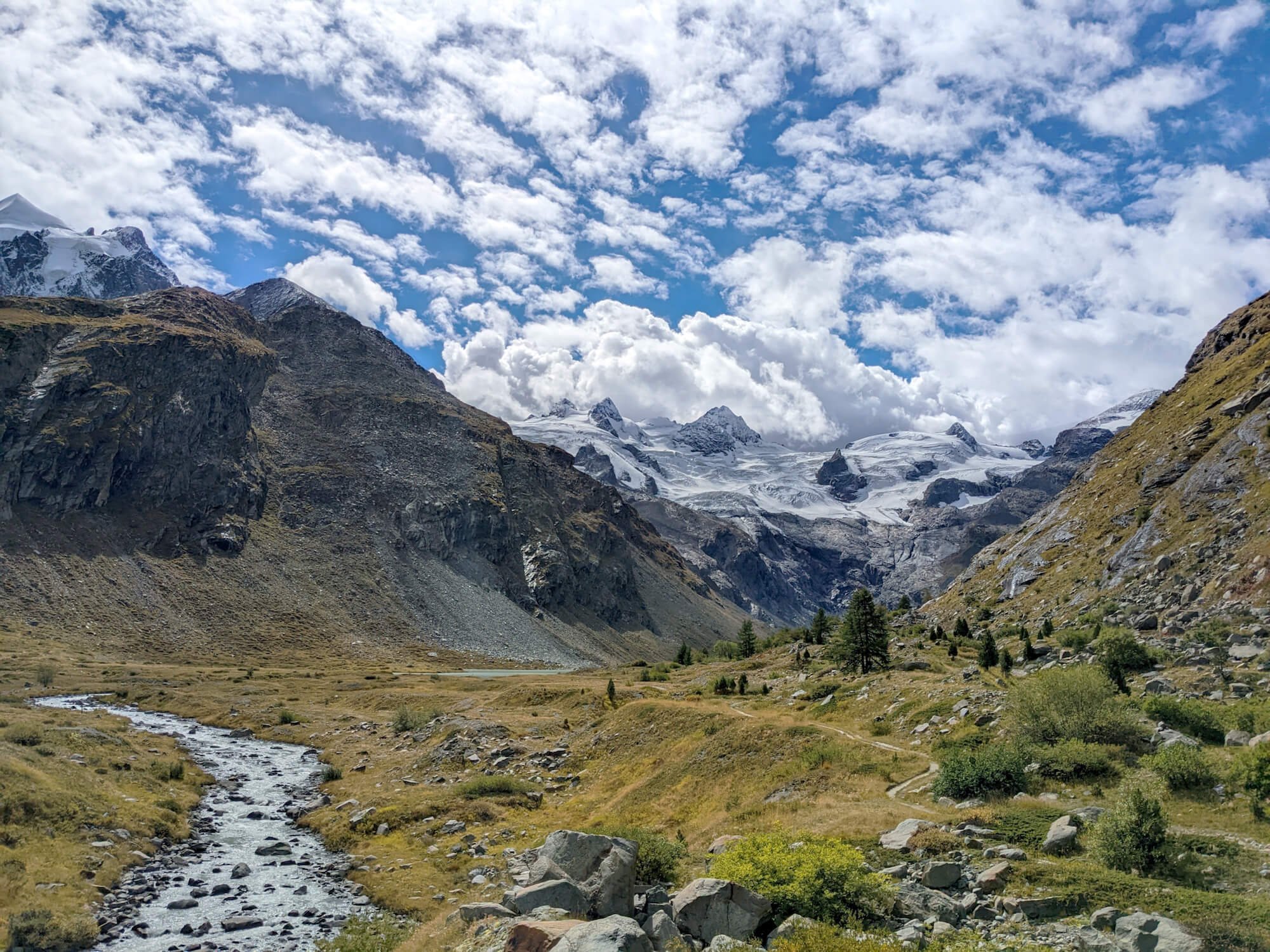
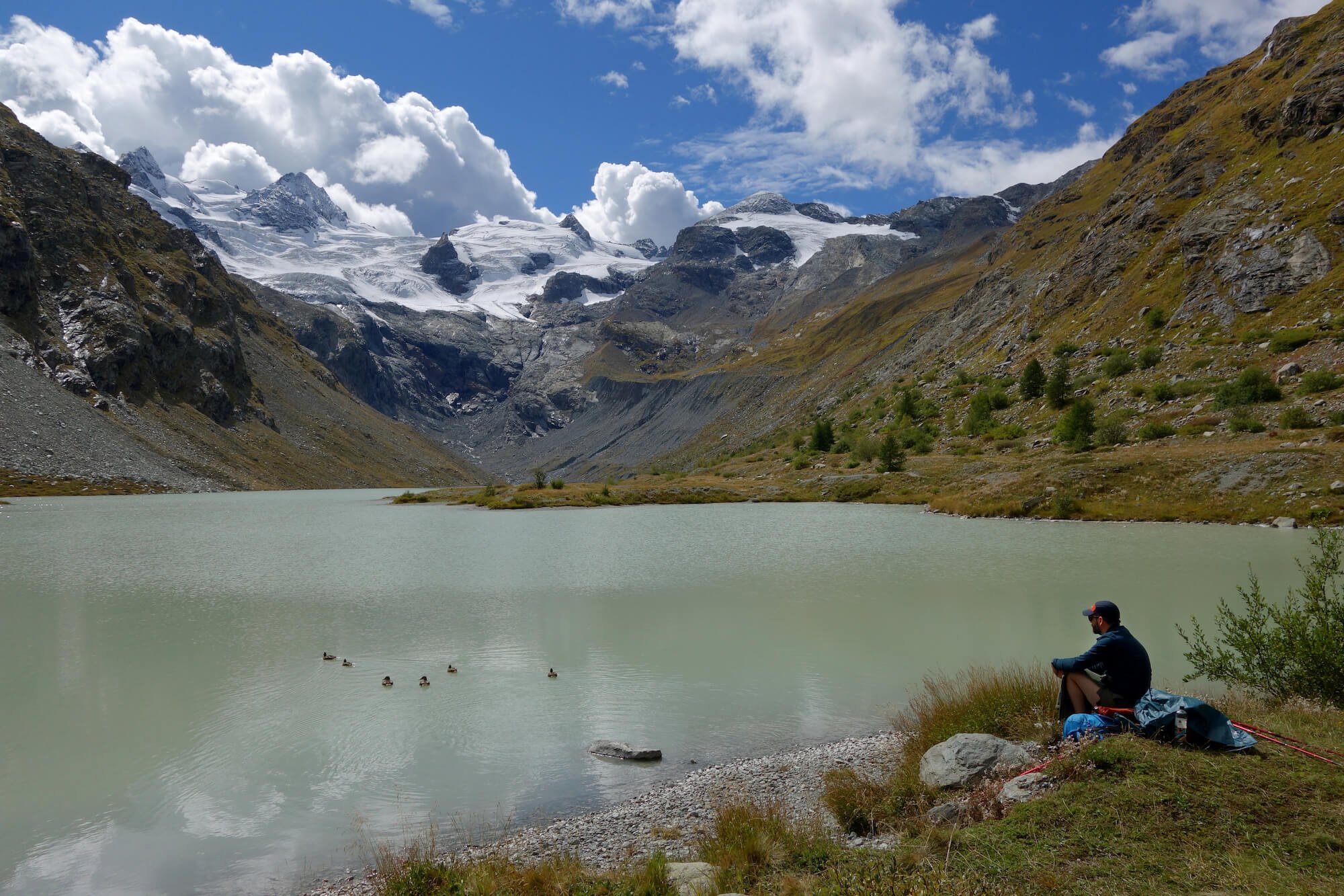
In order to avoid too much descent, we did a version of this hike in reverse. Leaving from Pontresina, we walked for many miles through misty woods, which eventually gave way to big views of the peaks at the head of Val Roseg. The viewpoint near the Hotel Restaurant Roseg Gletscher, which you can take a horse-drawn carriage to, was unbelievably beautiful. The local ducks are living their best lives.
We headed up the valley; flat trails turned rocky as we approached the ice-blue Lej da Vadret. Here we had lunch and fended off some curious ducks. We made a mistake and didn’t take the trail that follows the lake and would have taken us to Fuorcla Surlej (next time!), so we ended up backtracking 1.5 miles to a different trail.
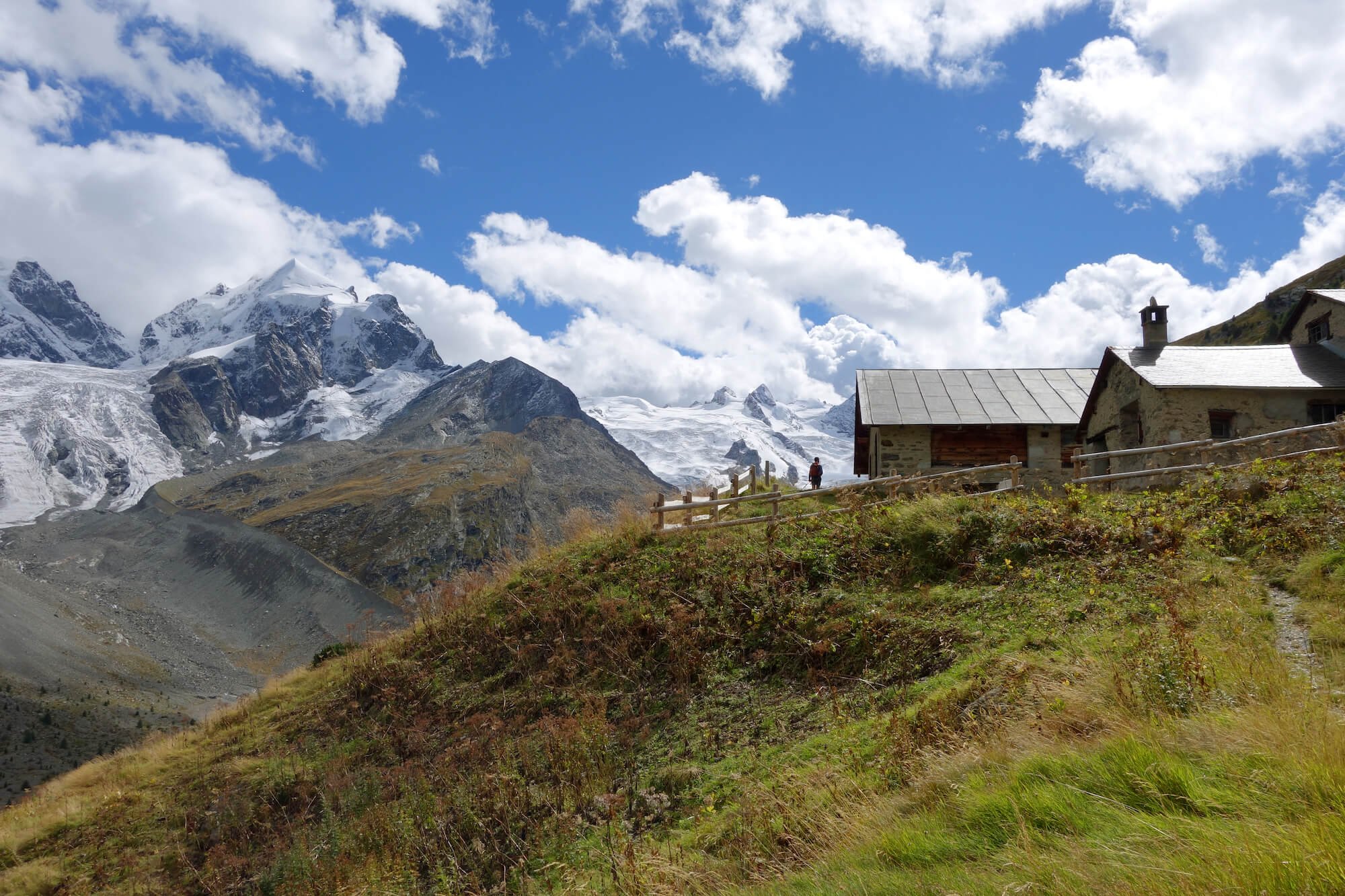
We took our sweet time on the ascent, admiring the glaciers, until we both realized we hadn’t checked the lift schedule. This rookie move forced us to haul ass like we’ve never hauled ass before up that pass. Luckily, we made the second to last lift down to Surlej, where we took a bus to Silvaplana and had burgers and spritzes to reward our effort. This hike is one of our all-time favorites!
“Rest” day: Diavolezza Glacier and biking around the lakes
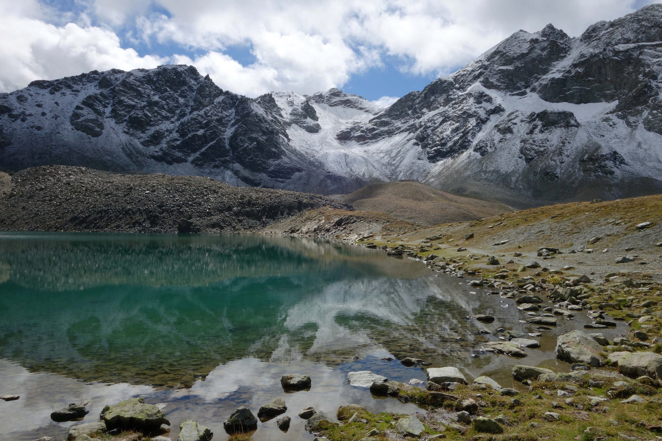
Walking proved to be painful this day, so an easier adventure was in order. This allowed us to explore the area in different ways. First, we took a train to the Diavolezza gondola, which we rode to the top. There we did a short and rocky hike with fantastic views of the glacier.
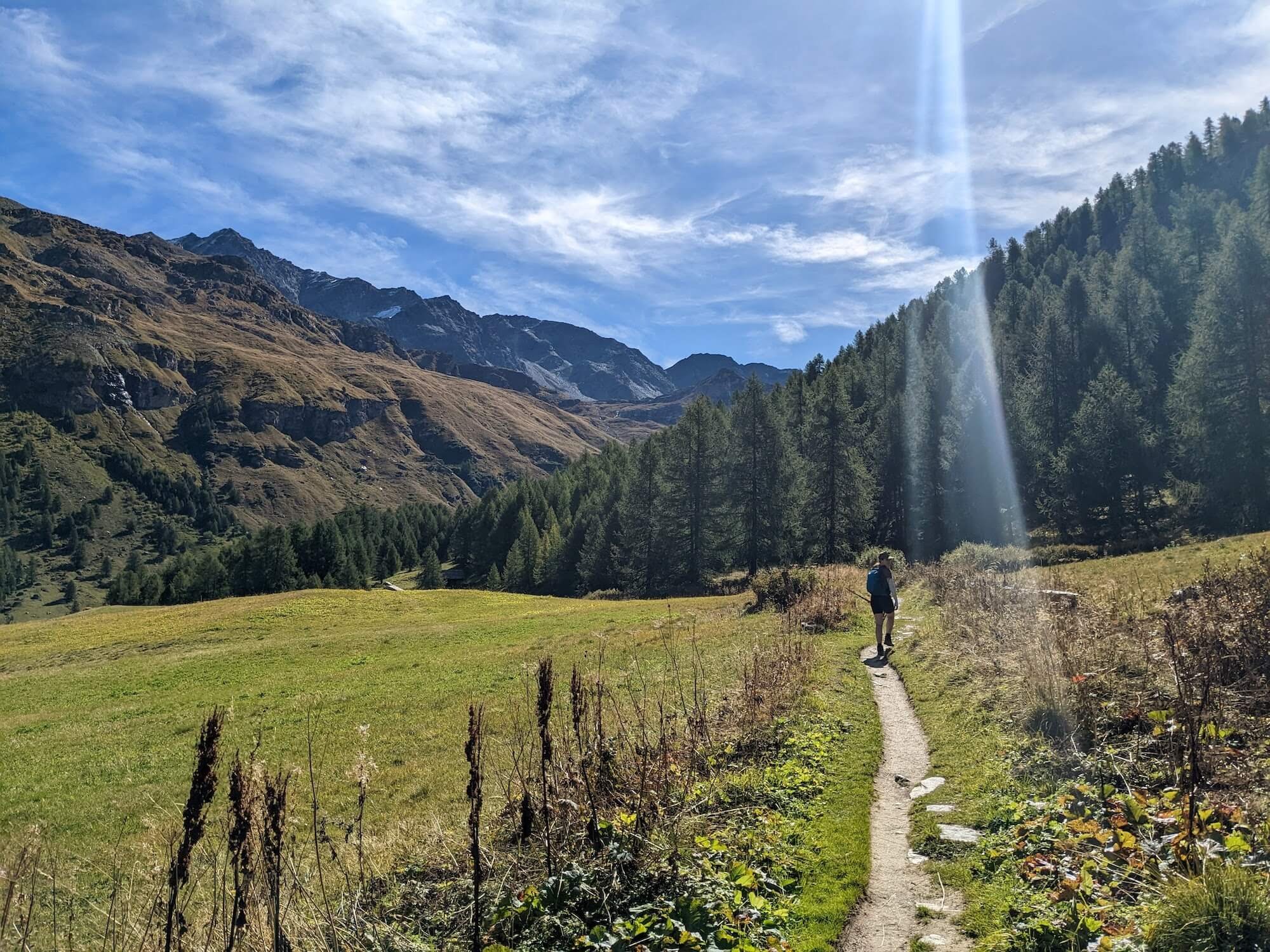
After heading back down to the valley floor, we learned that the next train wasn’t for another hour, so we opted to walk to the next station. This walk was quite nice; it meandered through the sunny valley, the woods, and past a couple small waterfalls. We arrived at the train station in the Morteratsch Valley, which we didn’t have time to explore, but looked gorgeous.
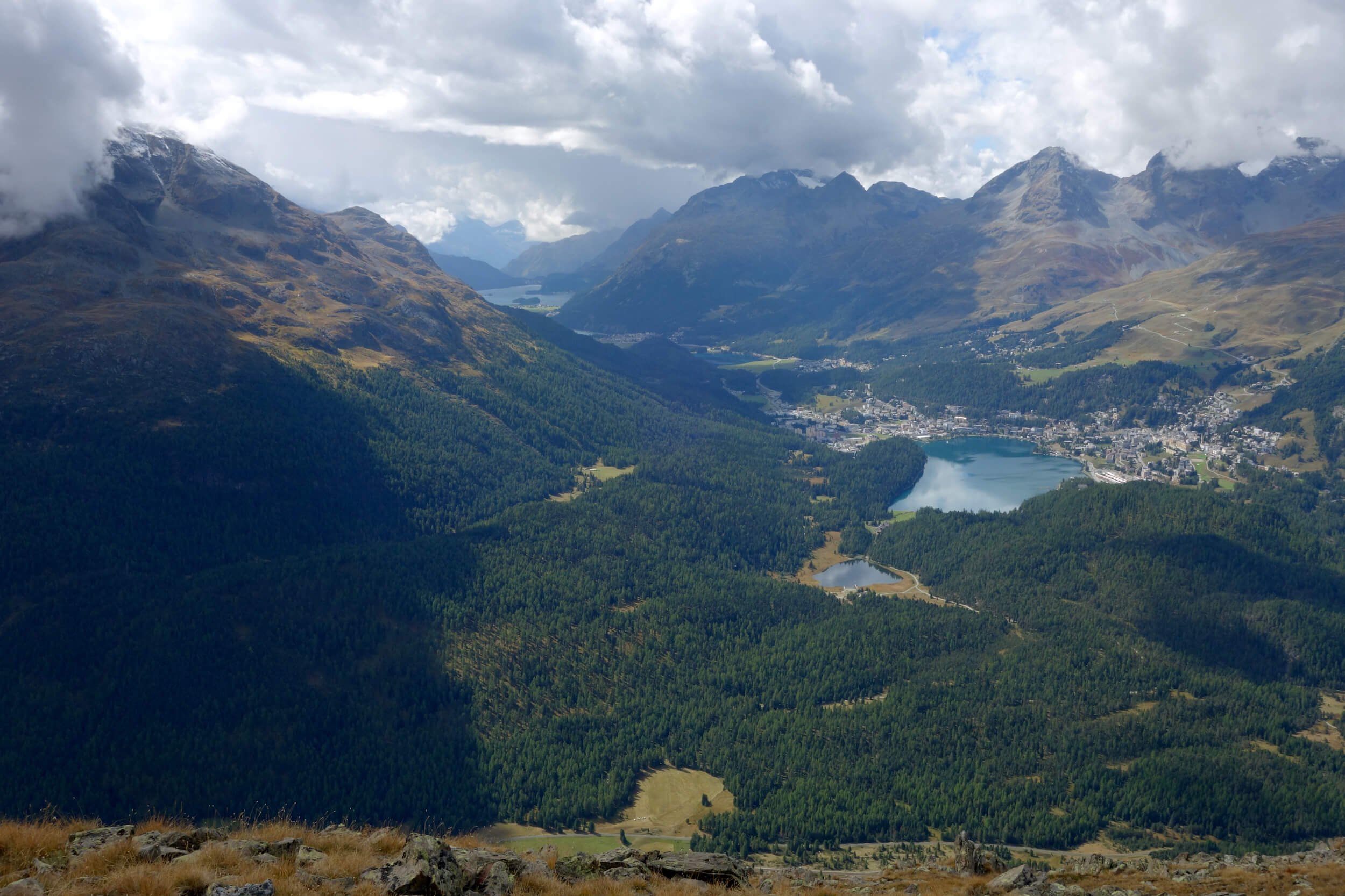
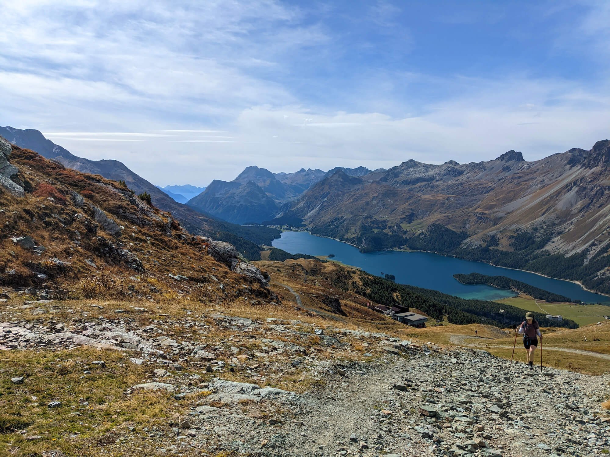
The next stop was St Moritz, where we got lunch from Coop and rented bikes. We spent the afternoon riding from one lake to the next, marveling at the different shades of blue and the light dancing off of the water and the surrounding peaks. If/when we return, I hope to spend an entire day relaxing on Lake Silvaplana (Silvaplanersee).

A stunning close-up view of the Diavolezza Glacier
Celerina-Marguns to Pass Suvretta to Chantarella-Corviglia

Route from Celerina-Marguns to Pass Suvretta to Chantarella-Corviglia
Distance: 8.6 miles | 13.8 km
Elevation gain/loss: +2,665 ft / -1,910 ft | +812 m / -582 m
Lifts used: Celerina-Marguns (gondola) and Chantarella-Corviglia (funicular)
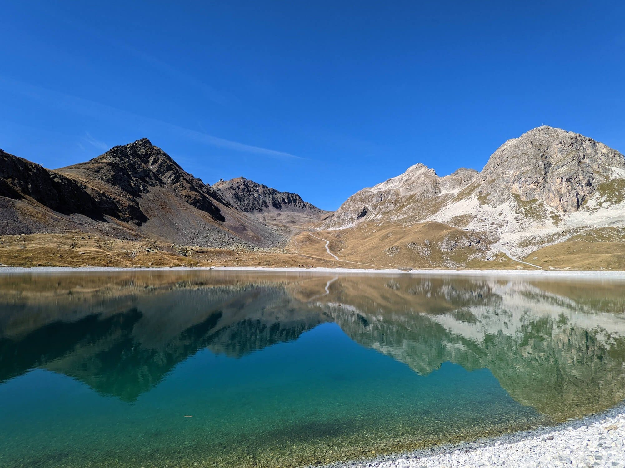
Ben and I wanted to do a hike on the northern side of the valley, so we cobbled this one together. It was a moderate hike that passed by Lej Alv (a pretty reservoir) on the way to Pass Suvretta, where we ate lunch next to sparkling Lej Suvretta. On the easy, quiet walk to the funicular we were treated with empty trails and wonderful, expansive views of the valley.
Val Fex

Route from Sils Maria to Furtschellas Mittelstation via Alp De Segl
Distance: 10 miles | 16 km
Elevation gain/loss: +3,100 ft / -1,400 ft | +945m / -427 m
Lift used: Furtschellas Mittelstation (gondola)
Val Fex is considered to be one of the most beautiful valleys in the Engadin, so of course we had to check it out. The valley is mostly car-free and truly enchanting. We took a bus from Pontresina to Sils Maria, a very sweet village nestled between Lake Silvaplana and Lake Sils (Silsersee).
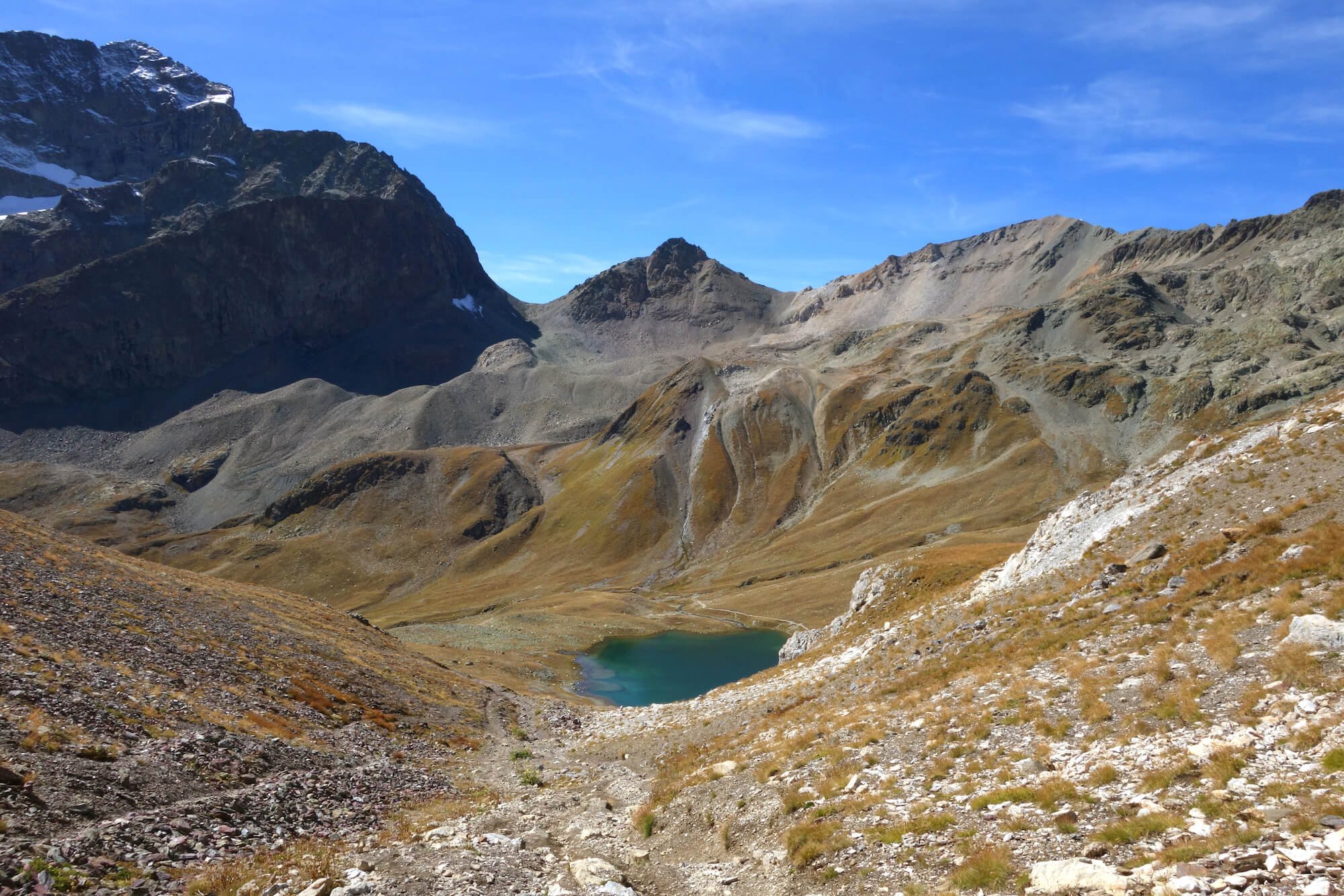
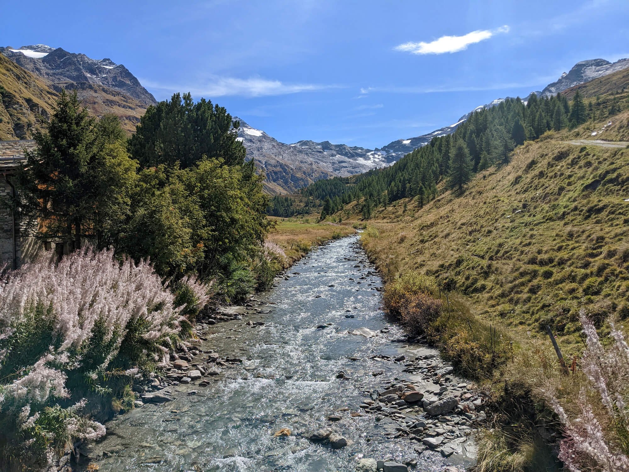
From here the trail climbed gently through the peaceful woods to the valley. Eventually we ascended past the tree line and went in search of a lunch hut, Alp De Segl, while taking in views of the peaks and glaciers at the head of the valley. We eventually found it, ordered food and talked with a kind Swiss couple on their holiday. The couple told us to come back in October so we can see the larches change color.
After lunch we descended to the valley floor, marveled at the sparkling grasses along the river, and eventually hiked up the opposite side of the valley to a viewpoint which gave us one last chance to take in the beauty of the Engadin from above. From here we walked around a few crystal-clear lakes and made our way to the Furtschellas Mittelstation, to conclude our final hike of the trip.
I cannot recommend the Engadin enough for a first or return hiking trip to Switzerland! It’s a bit off the beaten path (less than 4hrs train from Zurich) and has an abundance of beauty and convenience. Many hotels offer the Engine Inclusive pass, which can help cut costs and make it easier to explore the region. As for the hiking, we only scratched the surface. Day hikes are plentiful and there is also the Via Engiadina, a 160km trek. Traveling outside of peak season always makes it easy to find solitude on the trails and the towns have a pleasantly relaxed atmosphere. The Engadin holds a special place in our hearts and we can’t wait to return!
You can see more photos and read about our past trips @jernamcb on Instagram. My account is private, but if you DM saying you’re a Hiking Clubber, I’ll accept your follow!