File:Africa-political-map.jpg
Jump to navigation
Jump to search
Size of this preview: 630 × 599 pixels. Other resolutions: 252 × 240 pixels | 505 × 480 pixels | 807 × 768 pixels | 1,077 × 1,024 pixels | 2,088 × 1,986 pixels.
Original file (2,088 × 1,986 pixels, file size: 1.55 MB, MIME type: image/jpeg)
Captions
Captions
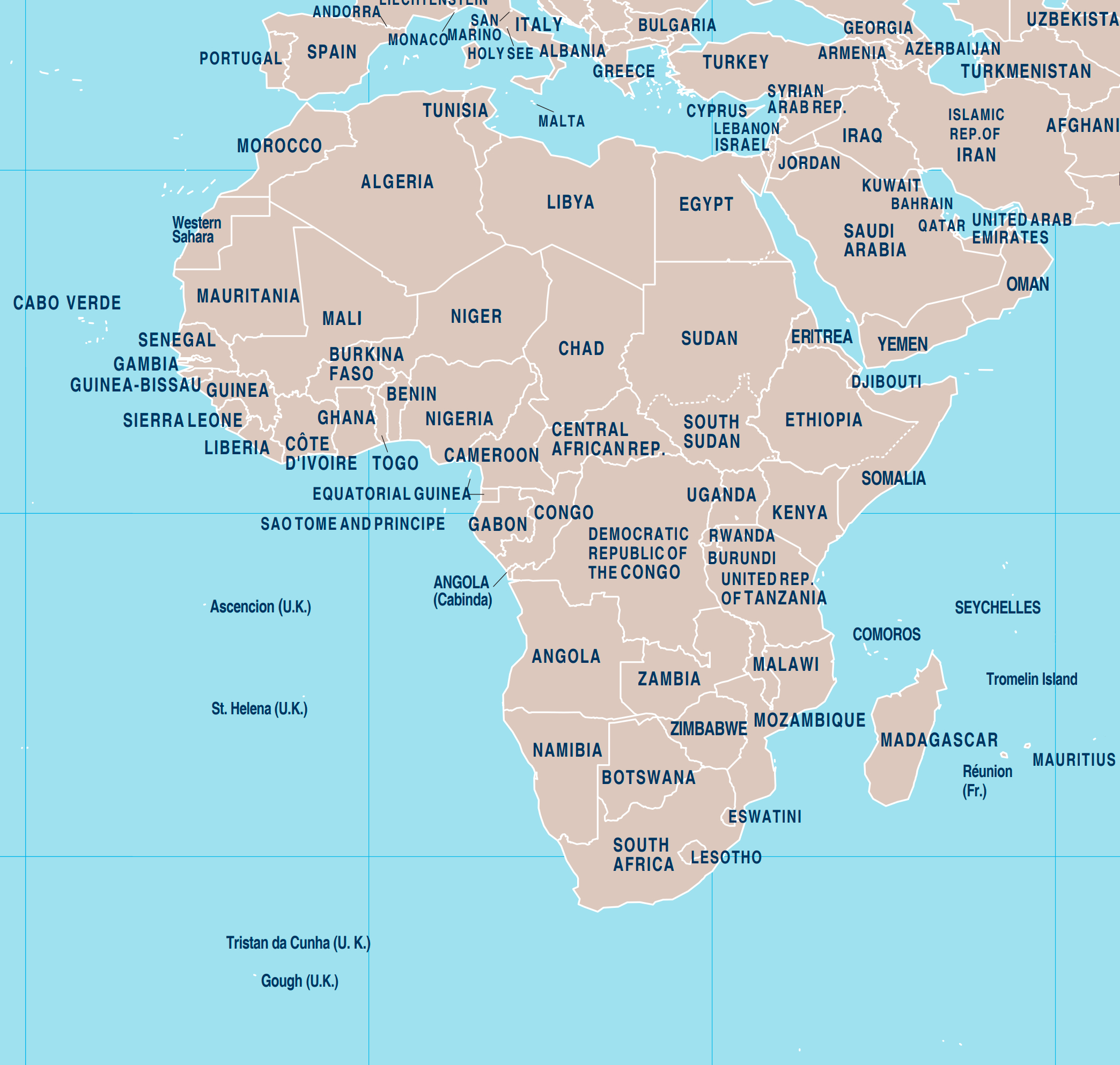
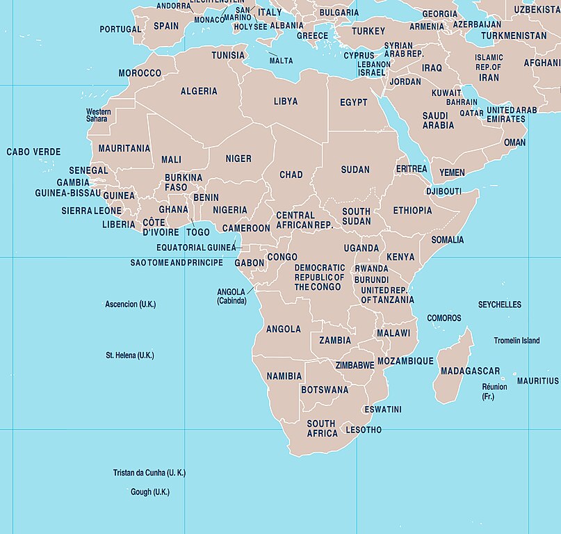
map of Africa
Summary[edit]
| Description |
English: The continent contains 54 fully recognised sovereign states (countries), eight territories and two de facto independent states with limited or no recognition. Algeria is Africa's largest country by area, and Nigeria is its largest by population. African nations cooperate through the establishment of the African Union. |
| Date | |
| Source | Own work using a fragment of the World Map 4170 R19 Oct20. Additional modifications have been made to the used fragment of the World Map 4170 R19 Oct20 map. A fragment of the World Map 4170 R19 Oct20 map with applied modifications was used in accordance with the conditions provided on the website https://www.un.org/Depts/Cartographic/english/about.htm |
| Author | Maps world |
Licensing[edit]
This file is licensed under the Creative Commons Attribution-Share Alike 4.0 International license.
- You are free:
- to share – to copy, distribute and transmit the work
- to remix – to adapt the work
- Under the following conditions:
- attribution – You must give appropriate credit, provide a link to the license, and indicate if changes were made. You may do so in any reasonable manner, but not in any way that suggests the licensor endorses you or your use.
- share alike – If you remix, transform, or build upon the material, you must distribute your contributions under the same or compatible license as the original.
File history
Click on a date/time to view the file as it appeared at that time.
| Date/Time | Thumbnail | Dimensions | User | Comment | |
|---|---|---|---|---|---|
| current | 20:02, 27 November 2021 | | 2,088 × 1,986 (1.55 MB) | Maps world (talk | contribs) | modify image |
| 13:30, 4 November 2021 |  | 1,200 × 1,399 (1.07 MB) | Maps world (talk | contribs) | modify image | |
| 13:12, 4 November 2021 |  | 2,445 × 2,851 (3.08 MB) | Maps world (talk | contribs) | modify image | |
| 00:23, 20 March 2020 |  | 2,500 × 2,661 (2.77 MB) | Maps world (talk | contribs) | map | |
| 13:54, 11 March 2020 |  | 3,980 × 4,236 (10.18 MB) | Maps world (talk | contribs) | Addition of information about doctors. | |
| 23:23, 29 February 2020 |  | 3,980 × 4,236 (10.1 MB) | Maps world (talk | contribs) | Addition of information on drinking water. | |
| 11:33, 23 July 2019 |  | 2,500 × 2,661 (1.43 MB) | Maps world (talk | contribs) | User created page with UploadWizard |
You cannot overwrite this file.
File usage on Commons
There are no pages that use this file.
File usage on other wikis
The following other wikis use this file:
- Usage on en.wikipedia.org
- Usage on fi.wikipedia.org
- Usage on id.wikipedia.org
- Usage on lt.wikipedia.org